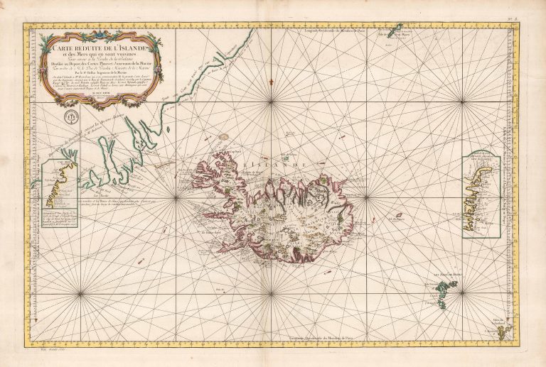
This is one of several maps showing Iceland prominently credited to Jacques-Nicolas Bellin. Its name says it covers Iceland and its neighbours, but Iceland is the main theme, only small part of Greenland is shown and the map just extends to cover the Shetland Islands to the south and Ian Mayen barely makes it onto the map in the North. Iceland is based on Horrebow, according to the text in the cartouche. He is also using Dutch sources and refers to them on the map itself, “suivant les Holland”. It is a sea chart and its purpose is to be used for fishing and whaling, see also rhumb lines and depth numbers. East of the country is the Isle Enchuysen, the island “discovered” by Joris Carolos. It does not exist. On Greenland, there is a text saying that Greenland here is based on ancient writers according to Anderson. Here he is referring to the map made by Johann Anderson in 1746. There are two inset maps, one of the Eastfjords, the other Westfjords, both further from the truth then on the main map.

Carte Reduite de l’Islande…
YEAR 1767
Technical data
Iceland
1767
Jacques-Nicolas Bellin
54,6 x 83 cm.