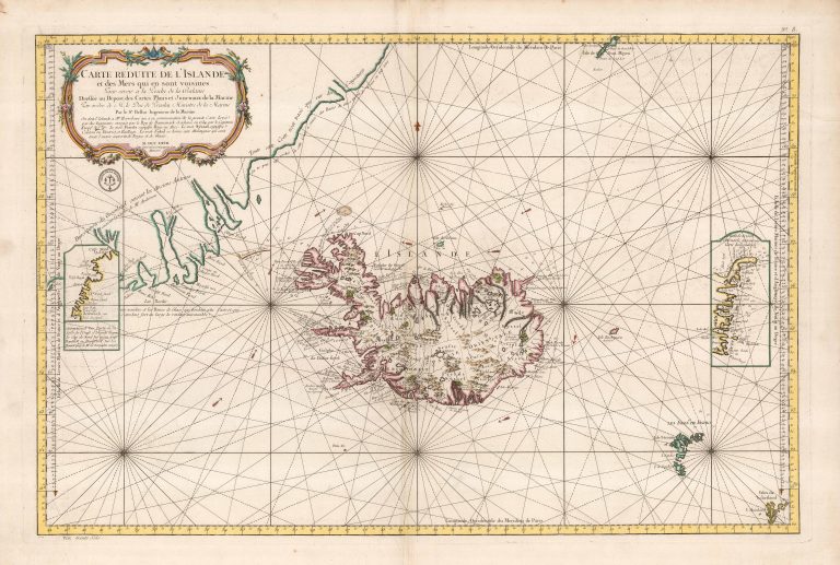
Bellin‘s sea chart with Iceland at its center, or as it is called A map of Iceland and its surroundings. The shape of the country is from Knoff‘s map, via Horrebow, the latter mentioned as source for Iceland, in the title shield. It is very much like other maps from around this time, credited to Bellin, for example Carte d‘Islande from 1768.
There are two inset maps, showing alternative East- and Westfjords, both much wores then how it appears on the main map. East of the country is the non-existing island of Enchuysen, discuvered by Joris Carolos and named by him after his hometown.
It is a majestic and beautiful map, in my humble opinion.