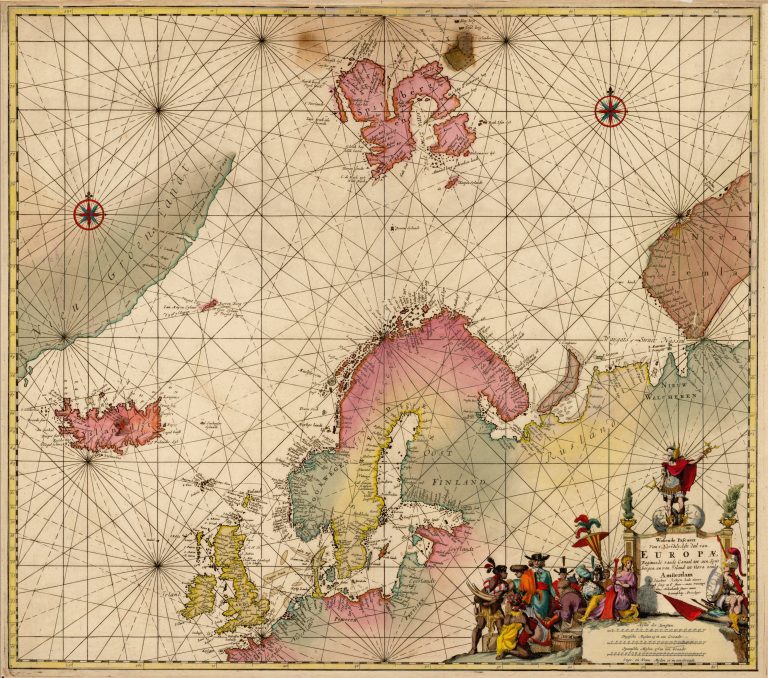
On this typical sea chart, from we see Jacobus Robijn showing Hekla as the only point of interest inland, not just in Iceland, but in the entire region he is covering. Hekla clearly was very famous in Europe at this time. The map also has quite a nice scene of merchants trading with indigenous people. The latter seem to be a bit less fully-dressed than was common in Northern Europe and
the Arctic at the time and, if this is ivory they are ofering, this was in short supply in the North. It was a lot of work to engrave such detailed and beautiful scenes. It would have been a shame not to use it, even if it was originally meant for a diferent chart. Notice the burn damage near the upper rim, slightly right of center. It is not unlikely that this chart was being looked at in a dark sea cabin, held close to candlelight. Most maps and charts so old have some sort of damage on them or have been restored. The damage is a reminder that this is an item that is centuries older than harnessed electricity.
Wassende Pascaert Van t’ Noordelyckste deel… van Europae_Beginnende_vande
YEAR 1670
Technical data
North Atlantic
1670
Jacobus Robijn
53,3 x 58,4 cm.