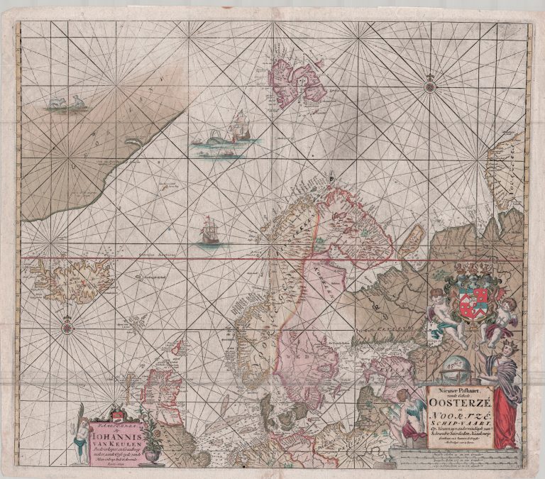
A beautiful sea chart by the Dutch Van Keulen family, one of the most important makers of charts at the time. Johannes also made the first chart dedicated to Iceland alone, in the same year. Iceland on this map is of similar shape to that. Interestingly, the only area showing dept numbers, appart from the North Sea and around Denmark, is around Iceland.
Niuewe paskaart vande geheele Oosterze en Noortze schipivaart
YEAR 1681
Technical data
North Atlantic
1681
Johannes Van Keulen
50,5 x 57,5 cm.