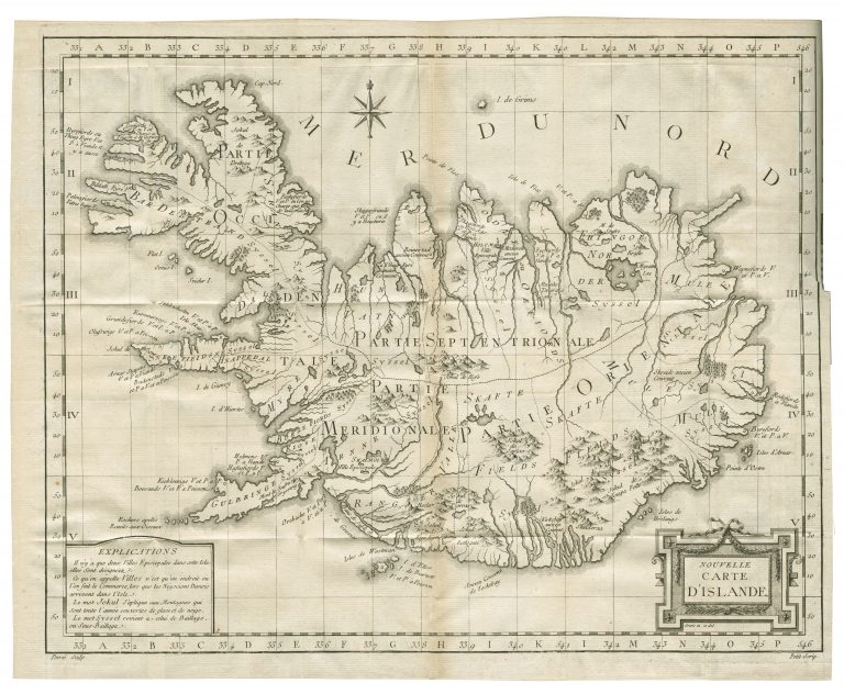
The French edition of Horrebow’s account of Iceland from 1752, Nouvelle Description Physique-Historique, Civile Et Politique De L’Iclende, had a map that was different from the Danish original. The country is slightly more to the east on this example and there are some differences in place names (Langanes is missing, for example). The compass rose is North of the country and in the lower left corner, there is a table of explanations. It is also, in my opinion, better engraved and the place names are better situated, so the overall appearance is much improved. The French editions’ map is the only one that is signed: “Perrié Sculp” and “Petit Scrip”.
Nouvelle carte d‘Islande
YEAR 1764
Technical data
Iceland
1764
Niels Horrebow
29,6 x 37,6 cm.