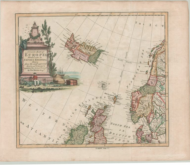
This map is one of 4 sheets showing Europe, as the name indicates. Iceland is in the shape intruduced by Herman Moll and then adapted by Emanuel Bowen, Kitchins mentor. The “body” of Iceland is based on Carolos, but the Westfjords and Snæfellsnes are probably made so based on some sea chart.
A Correct Map of Europe
YEAR 1750
Technical data
North Atlantic
1750
Thomas Kitchin
35 x 39,7 cm.