An American map showing the extent of explorations around the North Pole, with emphasis on the efforts to find a Northwest passage, showing Hearne’s and MacKenzie’s routes. The North Pole itself is labelled as “Frozen Ocean”, which is actually a fairly accurate description.
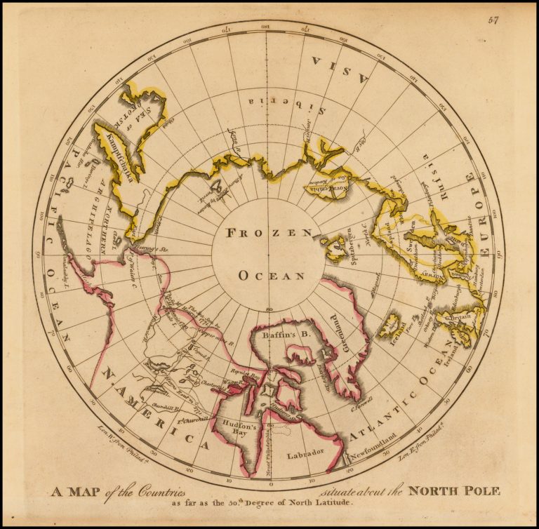
A Map of the Countries situate about the North Pole
YEAR 1809
Technical data
North Pole
1809
Matthew Carey
25,5 x 24,7 cm.