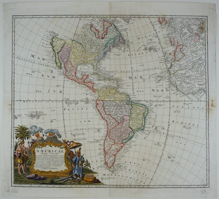
A map of America showing the boundaries between the influence or possession of the different nations. Thera are many new information on the map, including from Jesuits who explored the Mississippi area. The North West is sensibly left blank, the last name shown is Cuivira, the legendary land of gold and silver.
The map immediately precedes the French and Indian wars. The French hold most of Canada and Louisiana. English possessions are on the East coast, the 13 colonies, and the area around Hudson Bay, the latter governed by the company holding the same name. Spain holds Florida, New Mexico and California. The latter has stopped being an island and has the caption Nova Albion, Latin for New Britain, a name given by Cook who claimed it for his country.
Of course, the fact that there were people on all this land before the Europeans came is not considered, but native Americans are though shown on the cartouche.