This is one of the most famous early maps of America and one that had enormous influence on the future cartography of the New World. The West coast is of particular interest, the bulb on the Chilean coast (changed on later plates of the map), and the exaggerated breadth of the North American continent. California is shown as peninsula. The Strait of Magellan separates South America from a large southern continent.
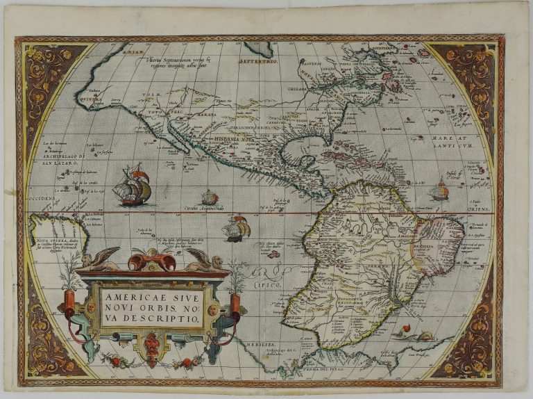
Americae Sive Novi Orbis Nova Descriptio
YEAR 1570
Technical data
America
1570
Abraham Ortelius
40,3 x 54,8 cm.