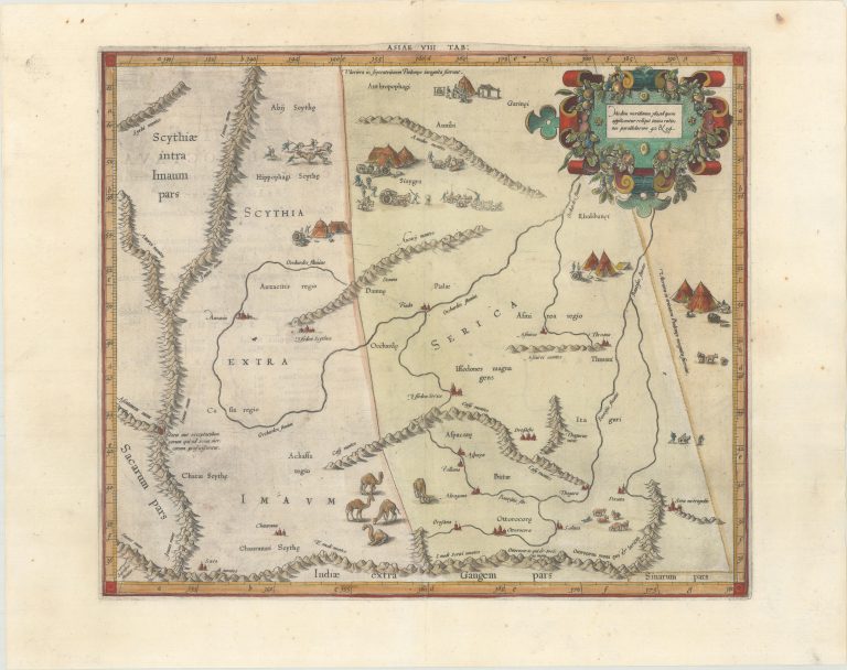
This fine copper engraved map covers Central Asia east of the Caspian Sea in what is now Tajikistan, Kyrgyzstan and western China. The Himalayas and Northern India run across the bottom of the map. The map includes several quaint scenes of the local people, encampments, camel herds, and the capture of wild horses. Mercator originally published this map in his 1578 edition of Ptolemy’s great Geography. Although he is most renowned today for the projection he popularized and for first using the term Atlas for a collection of maps, he devoted much of his life to his Ptolemaic maps. The maps were beautifully engraved as nearly as possible to their original form and embellished with fine cartouches. Published in Petrus Bertius’ Theatrum Geographiae Veteris… in 1618, which included maps by Mercator, Ortelius, and newly engraved maps by Pieter van den Keere. Latin text on verso. [from Oldworldauctions.com]
Asiae VIII Tab:
YEAR 1618
Technical data
Middle East
1618
Pierre Duval
34,5 x 40,6 cm.