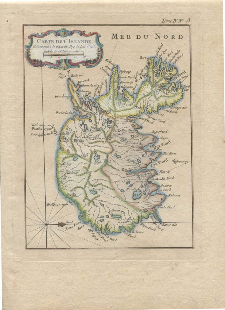
This map probably appeared in Le petit atlas maritime, but the reference “Tome IV.N°. 23” at the top border indicates it might be from a travel account.
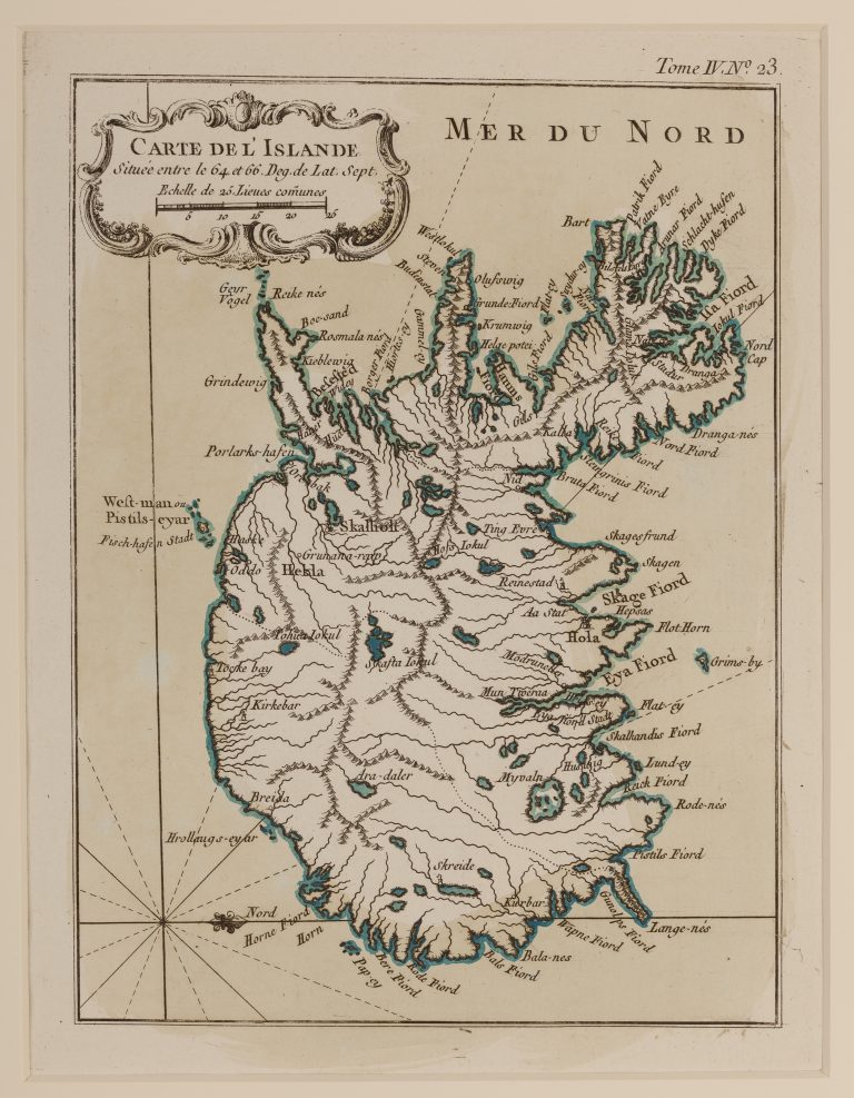
Carte de l’Islande Située entre les 64 et 66 Drg. De Lat. Sept
YEAR 1764
Technical data
Iceland
1764
Niels Horrebow, Jacques-Nicolas Bellin
21,7 x 16,2 cm.