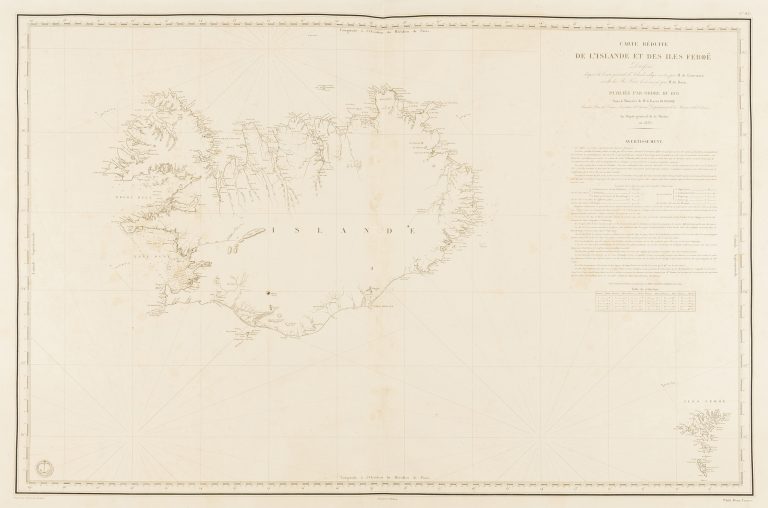
The French were very active in making of maps and charts, by this time mainly by its powerhouse in this area, Dépôt général de la marine. French fishermen were also quite active at this time around Iceland, so there is no wonder that there is a French map of Iceland based on the new surveys, completed in 1818.