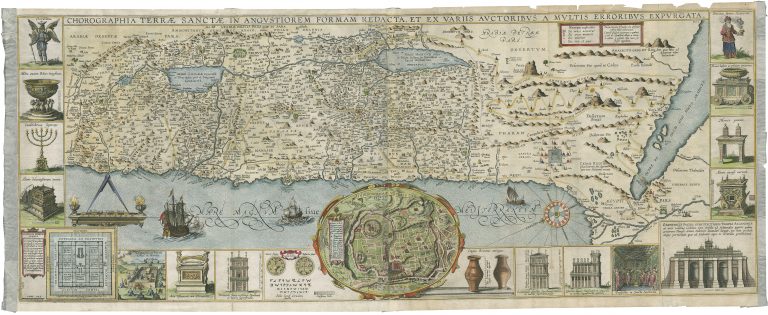
Detailed map of the Holy Land surrounded by 16 insets depicting temple features and instruments including the seven-branched candlestick, the Arc of the Covenant, the altar of sacrifices, the Holy of Holies, etc. At the center of the sheet, below the map itself, is a plan of ancient Jerusalem with a letter key to the principal monuments, and at lower left is a plan and elevations of the Temple. First published in 1632.
Chorographia Terrae Sanctae in Angustiorem Formam Redacta, et ex Variis Auctoribus a Multis Erroribus Expurgata
YEAR 1632
Technical data
Holy Land
1632
Jacobus Tirinius
32 x 81,5 cm.