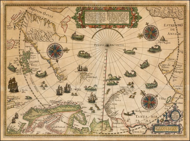
The depiction of the North Pole was based on pure speculation. It was, in fact, not until 1596 that expeditions reached as far North as 78° N.
This map was produced following the trip, engraved by Baptist van Doetecum. It is usually credited to Barentsz himself, even if his role in it is uncertain. As in the case of Mercator’s Septentrionalium, it is indeed a spectacular map. It is furthermore based on actual discoveries, such as that of Spitzbergen and the West coast of Nova Zemlya. Iceland is in the recognizable shape of Gudbrandur, but likely via Waghenaer, whose map must have been used on the voyage. It is, therefore, a bit out of shape. On the map we see Frisland and Estotiland, courtesy of Zeno. The North Pole itself is not really depicted, which is close to reality as there is no land there, unlike the South Pole. Notice that the East coast of Nova Zemlya is not outlined and so it would be shown (or, rather, not shown) on maps for many decades, for example on Blaeu’s World Map of 1662. Sometimes it is better to leave things out than to make things up. The Barentsz map might have been very influential on further exploration of the far North.
The map was published separately.
Deliniato[…]/Beschryvinge[…] [The North Pole map]
YEAR 1598
Technical data
North Pole
1598
William Barents
43.2 x 55.9 cm.