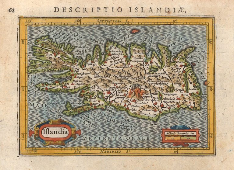
In 1616 Jodocus Hondius Junior published a book, P. Bertij Tabularum Geographicarum, with miniature maps. The text of the book is made by Petrus Bertius and the map is sometimes credited to him. Kaerius mostly used the Mercator/Hondius atlas as his model and this was so in the case of Iceland, with the over 100 place names coming from the Islandia of Mercator. The map, Descriptio Islandiæ, is extremely well done. The mountains in the highlands are depicted in great detail, with Hekla again dominating the scene. Hekla is roughly in the right place. But the rest of the interior is conjecture.
Descriptio Islandiæ
YEAR 1616
Technical data
Iceland
1616
Petrus Kaerius
Jodocus Hondius Jr.
9,3 x 13 cm.