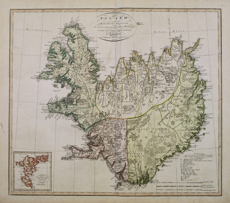
This map shows the differences in the shape of Iceland based on earlier measurements, vs. new measurements based on the results of the French expedition led by Verdun de la Crenne, in 1771.
Doppel-Charte von Island
YEAR 1800
Technical data
Iceland
1800
Johann Christoph Matthias Reinecke