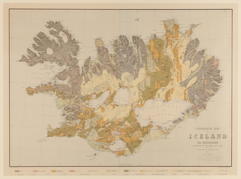
Until this time, maps of Iceland had been based on the maps of Björn Gunnlaugsson and Olaf Nikolas Olsen, from 1844 and 1849, or the surveys that they had used. Emphasis had been put on the coastline and inhabited areas. Þorvaldur wanted to improve on this with his map on the geology of Iceland and travelled extensively around the highlands of Iceland. It can be said that with the appearance of Geological map of Iceland, all of Iceland was now properly surveyed and mapped geographically, in addition to geolocically.
Þorvaldur Thoroddsen (1855-1921) was an Icelandic geologist and geographer. Þorvaldur’s interest in geology is said to have been fuelled when he accompanied the geologist Johannes Frederik Johnstrup to Iceland in 1876, as a guide. Apart from making the first geographical map of Iceland, Þorvaldur write about volcanos, weather and other subjects. He was among the most respected scholars of his time in Iceland.