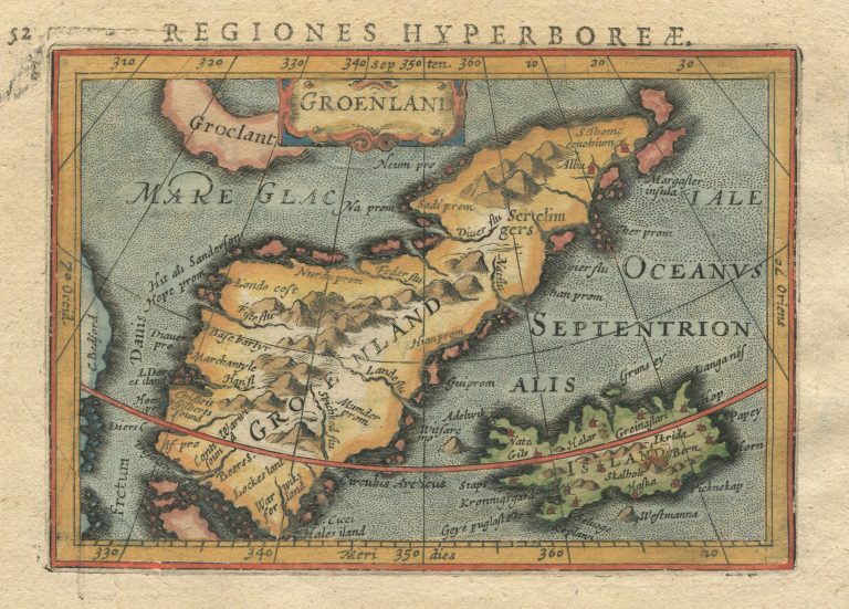
In 1616 Jodocus Hondius Junior published a book, P. Bertij Tabularum Geographicarum, with miniature maps. The text of the book is made by Petrus Bertius and the map is sometimes credited to him. Kaerius mostly used the Mercator/Hondius atlas as his model.
Groenland
YEAR 1618
Technical data
Iceland, Greenland
1618
Petrus Kaerius
Jodocus Hondius Jr.
9.2 × 13 cm.