The western part of the country is particularly out of shape, perhaps like the island has antlers. This shape likely comes from some sea chart. It is, however, not a chart, even if it has a nice compass rose in the lower-left corner; there are no rhumb lines, for example. This map was also issued by Carrington Bowles in London in 1784.
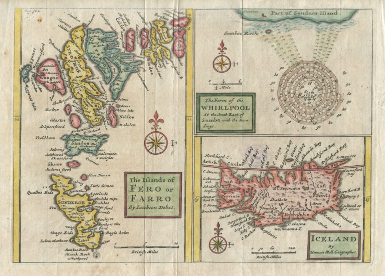
Iceland
YEAR 1730
Technical data
Iceland
1730
Herman Moll
8,9 x 12,2 cm.