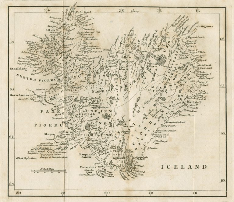
This map, based on Verdun de la Crenned measurements, appeared in William Hooker’s book about Iceland, Journal of a Tour in Iceland in the summer of 1809, published in its second edition in 1813 (the first edition, without a map, was published in 1811). Hooker, a Scottish botanist, had some adventures on his Iceland trip. First he was present when a Danish officer, Jørgen Jørgensen, led a coup and crowned himself the King of Iceland. The British Royal Navy dethroned him, taking him to England. Hooker hitched a ride. On the way there the ship burned, with the crew barely escaping. In any case, back to the map in Hooker’s book. It is one ugly map, in my humble opinion. In addition to the shape, the map is crowded and does not bother with as important a fact as the outlines of Vatnajökull.