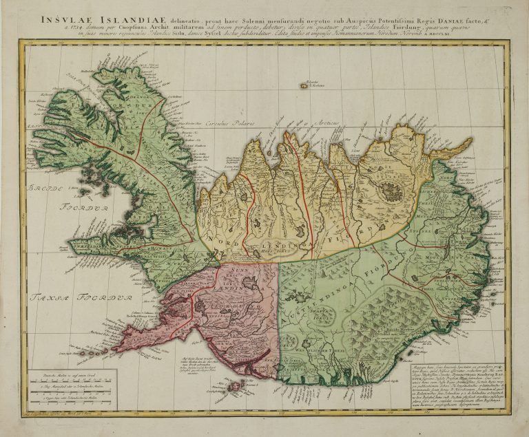
This general outline version of Iceland is usually named after Thomas Hans Henrik Knoff. It was he who first made a map based on new calculations, even if that map was not published. It was the Knoff map, and not Horrebow’s, which was the template for this map which was published in Nuremberg in 1761 by Homann Heirs. Johann Baptist Homann (1664–1724) was an active publisher who was largely responsible for making Nuremberg one of the main centers of map publishing in the eighteenth century. After he died, his son took over, but he didn’t live long. In his will he donated the company to his friends, with the condition that the company would be called
Homannische Erben, or Homann Heirs. Homann Heirs would publish many maps, including a new map of Iceland, Insulae Islandiae. It appears to have been decided that the Horrebow map had not done justice to the map Knoff made and that it was necessary to get the best publishers to do this properly.
Tis map was published separately and is much larger than the previous maps of this version, which were all of similar size, ca. 30 x 38 cm. Its scale is 1:1,500,000. It is much more detailed than the previous similar maps and it was printed on much better paper. Hekla had appeared on the other Knoff maps as a moderately sized mountain, with what appears to be smoke coming from it, although the fire is gone. On the Hoffman map, the smoke is gone as well and Hekla is just
another mountain. The glaciers are still shown as groups of mountains and the interior of the country is not very well depicted in general. Because of how detailed it is, this map is a huge improvement over all previously published maps and would be the model for many others in the next decade.