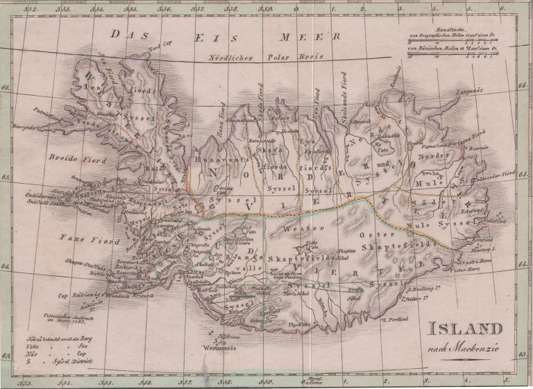
Inset map on Das Königreich Daenemark, in composite atlases. As the title says, the map is based on the map made by Sir George Steuart Mackenzie, published in his book Travels in Iceland, in 1811. This map does though have a few more place names, so the Mackenzie map was not the only source. What is different from other maps is the peculiar shape of the Westfjords, presumably an invention of Sir George.