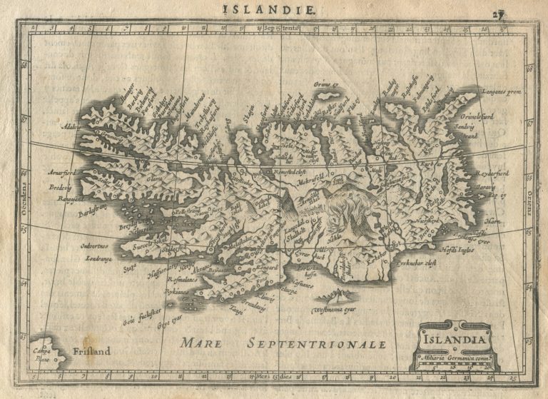
Johannes Janssonius, Hondius’ (Sr.) son-in-law, published in a revised version of Atlas Minor in 1628. It had a map of Icleand engraved Petrus Kaerius. The shape of Iceland presented by Ortelius seems to have been used, and the mountains are of his map, not that of Mercator. This map would be the model for a Peter van der As’s Islande, published in Nouveau petit atlas ou Nouvelles Cartes géographiques, qui toutes ensemble forment, en général la description de tous les païs qui existent sur la face de la terre, in 1710. Perhaps even the same plates were used, I have not yet had the opportunity to compare the two properly. It is quite nice map, in my opinion…..
Islandia
YEAR 1628
Technical data
Iceland
1628
Jan Janssonius
13,5 x 19,3 cm.