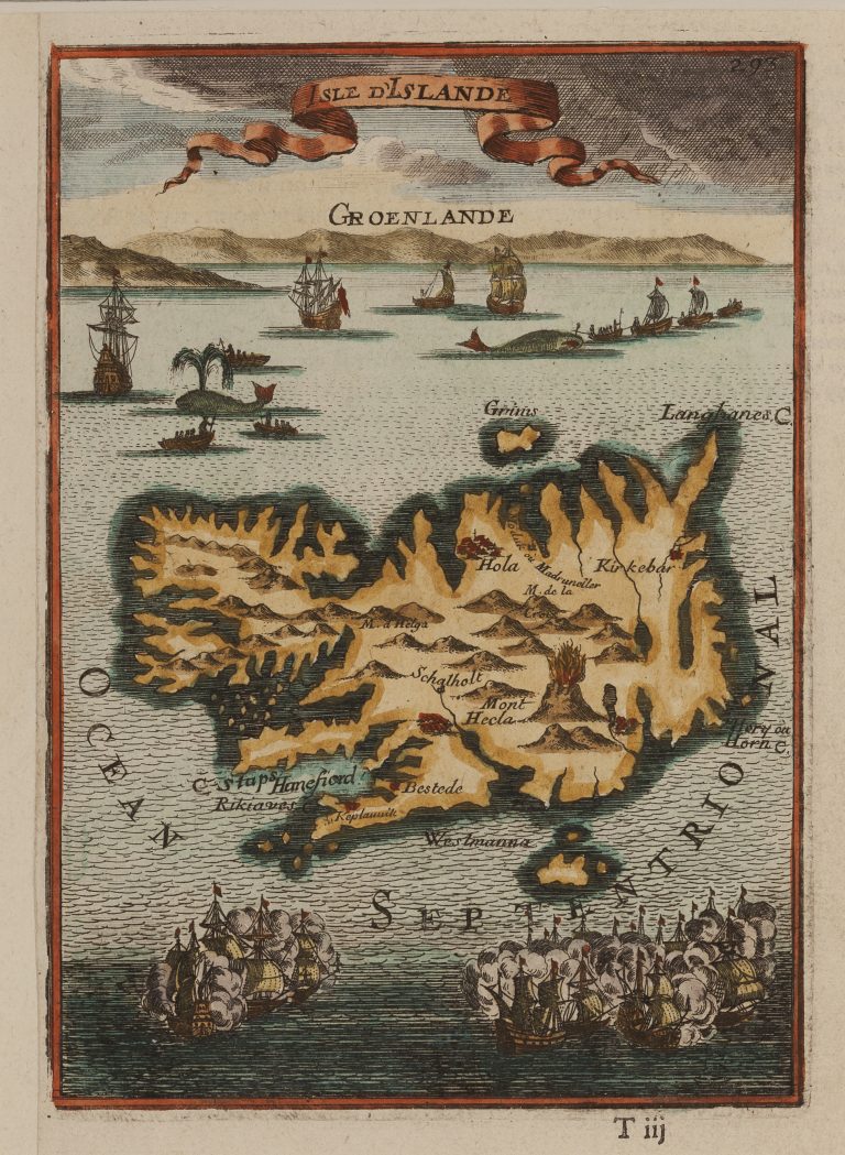
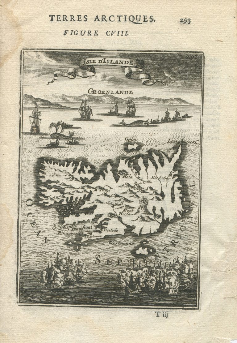
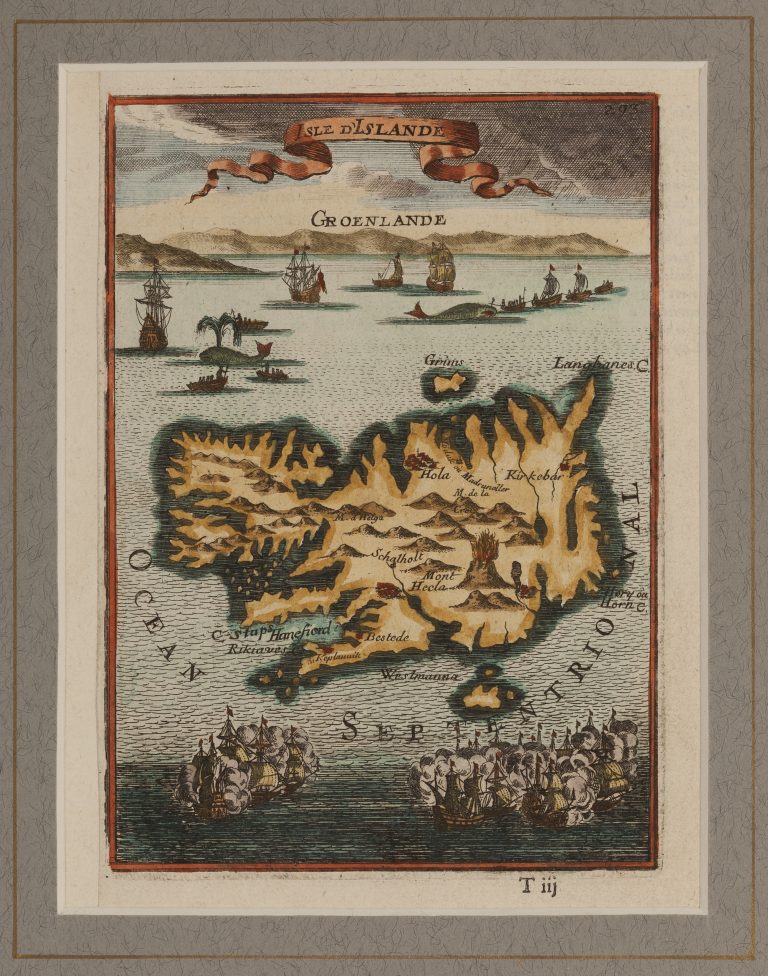
Alain Manesson Mallet published a five volume work in 1683, Description de l’universe, with maps and descriptions of the whole world. Iceland appears on many of the maps. The books are small folio in size and the maps small, ca. 14 x 10 cm. One map shows the North Atlantic and is titled Decowerte De La Groenlande. Another is titled Isle d‘Islande. The shape of the Carolus map is clear on both maps, and especially so on the smaller picture of Iceland. On the map dedicated to Iceland alone one can see whaling scenes in the background and, at the bottom, a sea battle. In this book there is a picture of Hekla According to Sigurðsson (Kortasaga Íslands, 1978, p. 54) it is probably the first stand-alone picture of that famous volcano. The book was published in the German language two years later. The same maps were used, but the language changed and an unfortunate mistake was made when it came to the map of Iceland; it was flipped over.
Isle d‘Islandia
YEAR 1683
Technical data
Iceland
1683
Alain Manesson Mallet
14,5 × 10,5 cm.