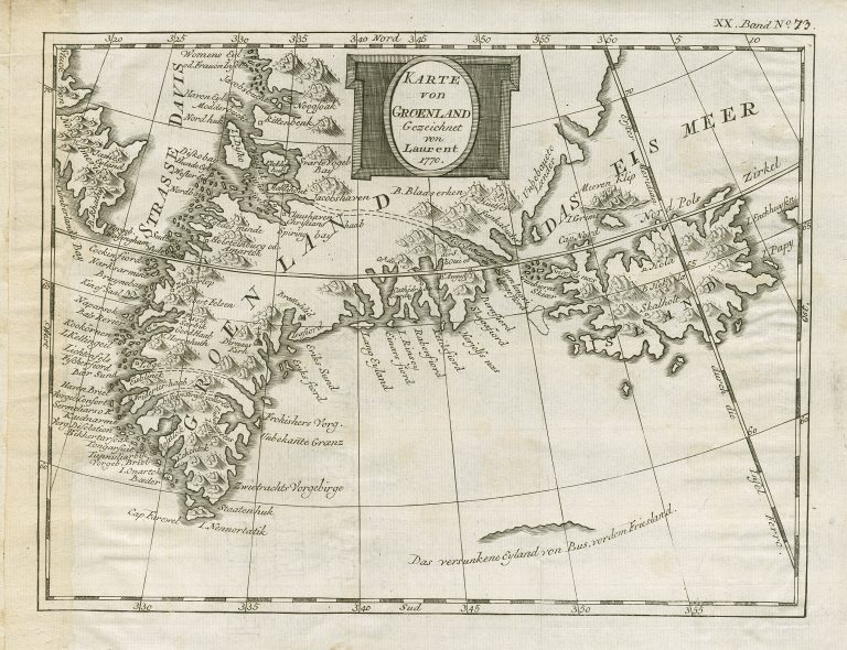
The German version of Bellin’s or Laurent’s map showing Greenland and Iceland, based on the map of Johann Anderson of 1746.
The map shows the place where the sunken island Bus, formerly Friesland (sic) was situated. Thsi is a nice way to correct previous errors on maps!