Bellin was a hydrographer and geographer; he worked in this profession for fifty years, thirty of them as head of the French Hydrographic Office, the Depot de la Marine. Because of his long career and official post, there are huge numbers of maps credited to him, perhaps more than any other cartographer. How much he contributed in each case is uncertain.)
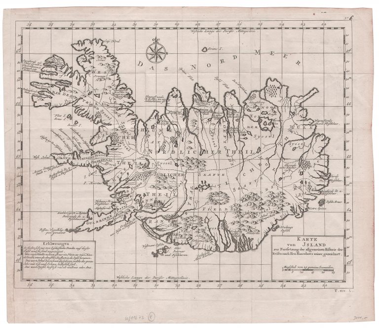
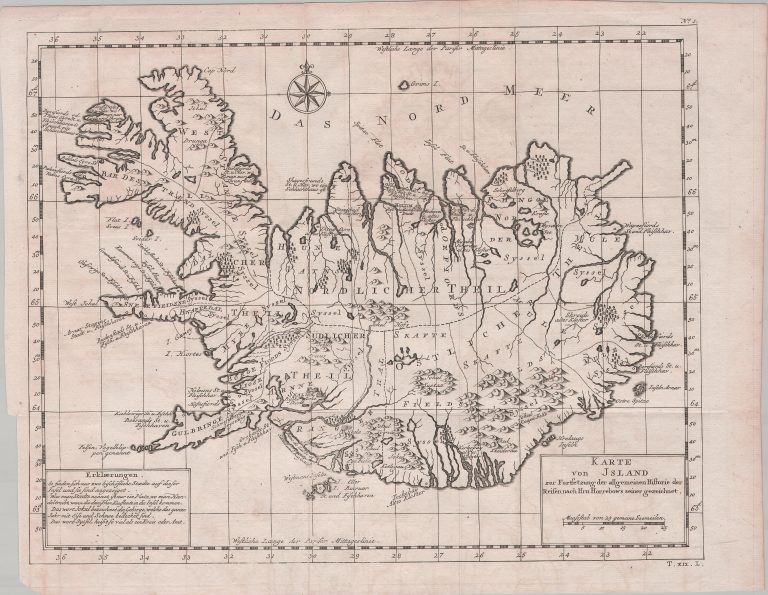
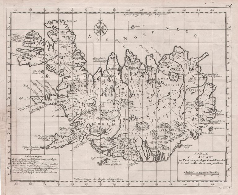
The Allgemeine Historie Der Reisen zu Wasser und Lande included translated English accounts and materials from Prévost. Prévost’s account of Iceland, largely based on Horrebow, but also on others, was published there in 1769, in volume nineteen. It was accompanied by a map, Karte von
Jsland, which was clearly based on the map from 1764 (Petit Scrip), rather than the original Horrebow map of 1752. This can be seen by the fact that it follows the French map in all the ways those two differed.