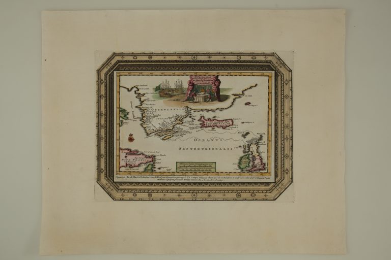
The map shows the route of Martin Frobisher, when he sailed looking for the North-West passage to China in 1576. He did not find it and did not go far enough either to find that it does not exist. However, he found some ore which he brought back and got financers to back another bigger fleet, to collect more ore, which Frobisher believed contained gold. Turned out it didn’t. Frobisher later joined up with Francis Drake and became what the English called privateer and other nations called pirates. He played a role in repelling the Spanish Armanda in 1588. That was about Martin Frobischer. About the map, there is not so much to say. It appeared in a collection of travel accounts, by van der Aa, Atlas nouveau et curieux. The shape of Iceland is based on sea charts. The decorations are though not bad and appearing in the middle of a group of people consulting maps is none other than Queen Elizabeth I of England, who was one of Frobishers backers; the Virgin Queen, whose father (Henry VIII) had her mother (Anne Boleyn) beheaded. When there is not much to say about a map, the story can drift off…
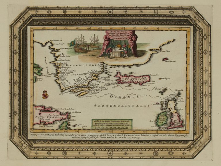
M. Frobishers Scheeps…
YEAR 1714
Technical data
North Atlantic
1714
Pieter van der Aa
16,1 × 22,6 cm.