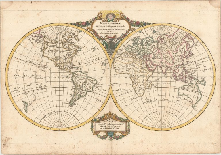
This decorative double hemisphere world map traces the route of Captain Cook, with a note in Hawaii commemorating his death. Just two cities are named in the United States, Boston and New Orleans, and, with the exception of Florida, the entire east coast of the United States is labeled N. Angleterre. To the west is a massive Louisiana Territory, and farther west is Nlle. Navarre, and Californie. The northwest coast of North America is depicted in an odd configuration, and there is a Northwest Passage stretching from the Hudson Bay to Cotes vues par les Russes. A section of Australia’s coast is conjectural, and Tasmania appears to be attached to the mainland. New Guinea also has an incomplete coastline. A fragment of coast identified as Terre de la Compagnie appears to the northwest of Japan. The map is decorated with two cartouches tucked between the spheres, engraved by Groux. Dated both 1795 and An. IIIe de la Republique Francaise. [from Oldworldauctions.com]
Mappe-Monde par Robert de Vaugondy Geographe…
YEAR 1795
Technical data
World
1795
Robert de Vaugondy
26,9 x 43,4 cm.