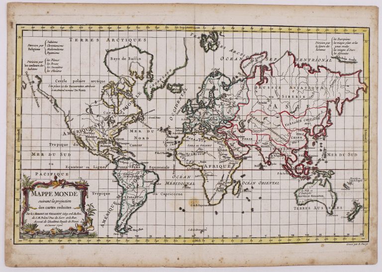
World Map on Mercator’s Projection, with original outline color showing the areas associated with the four major religions of the world: Christianity, Islam, Judaism, and Paganism.
The cartography reflects the most recent discoveries of the late 18th century explorers. Australia is outlined in full, including an attached Tasmania, as is New Zealand.
In North America, there is scant detail between Hudson Bay, marked as an English possession, and the Pacific Coast, where a printed note alludes to Russian discoveries. The map was engraved by E. Dussy and published by Fortin in Nouvel Atlas Portatif, Paris.
Mappe Monde suivant la projection des cartes reduites
YEAR 1778
Technical data
World
1778
Gilles Robert de Vaugondy
24 x 38 cm.