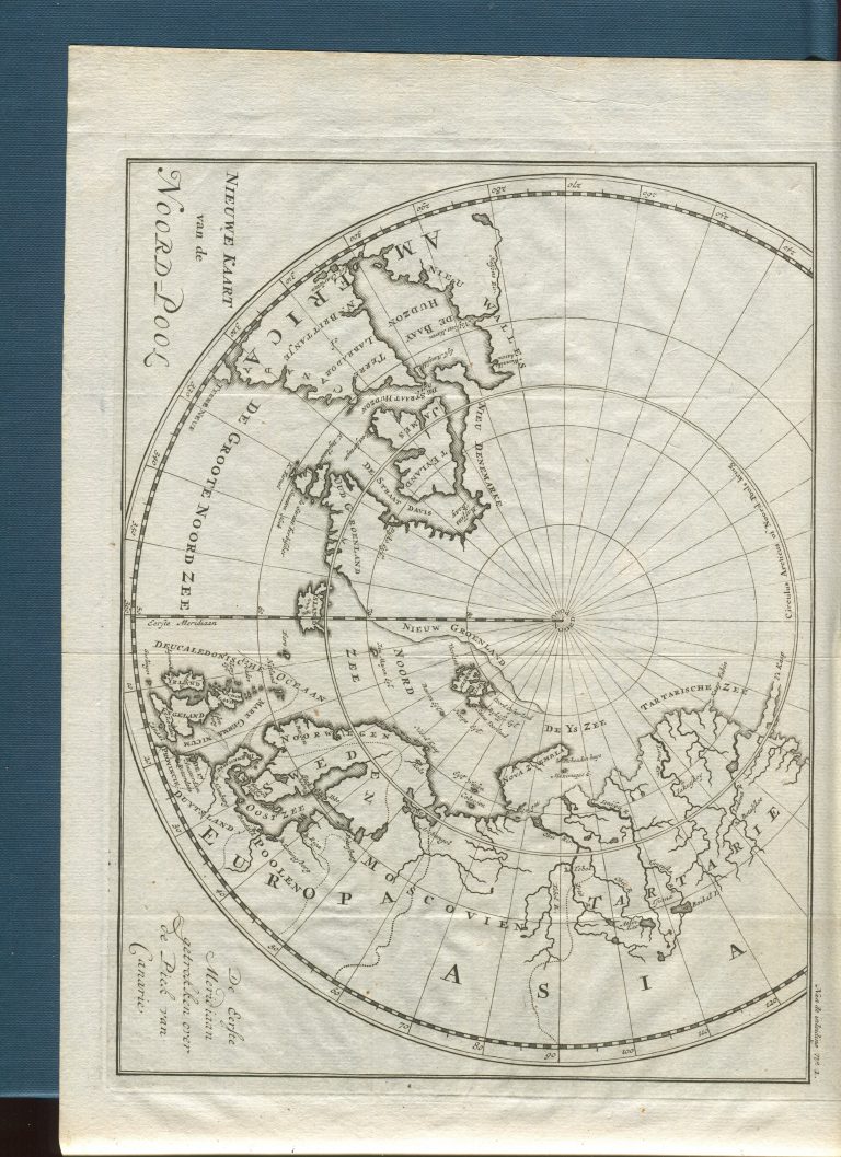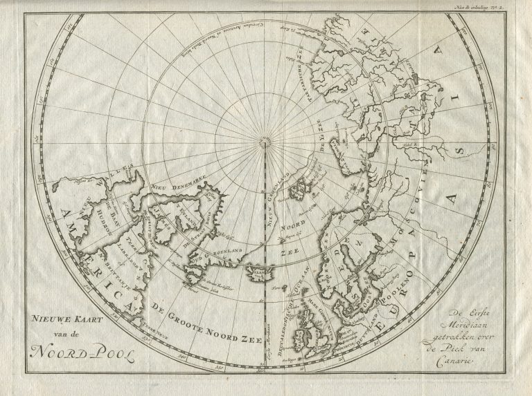
Appeared in Bloeyende Opkomst der Aloude en Hedendaagsche Groenlandsche Visschery, published 1720 and 1727, in Dutch. The same map appears in the German version of the book, Beschreibung des grönländischen Wallfischfangs und Fischerey […], 1723 and 1750, and in the French one Histoire des pêches, des découvertes et des établissemens des Hollandois dans les mers du Nord. Paris: Veuve Nyon, 1801. It also appeared in De Walvischvangst met veele Byzonderheden daartoe Betrekkelyk, Amsterdam 1784 and finally in Nieuwe beschryving der walvisvangst en haringvisscherij, Amsterdam 1791 (same book with new name!).
The coast of Greenland somehow drifts eastwards, north of Spitzbergen. This underlines how little was known of the area around the North Pole at this time.