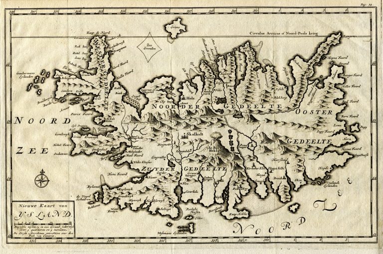
In 1720 Zorgdrager wrote a book about Iceland in which there is a map of Iceland titled
Nieuwe Kaart van Ysland. It is based on Van Keulen’s map of 1684. In his book, we find the oldest picture of an Icelandic hot spring. In Bloeyende Opkomst der Aloude en Hedendaagsche Groenlandsche Visschery, published 1720 and 1727
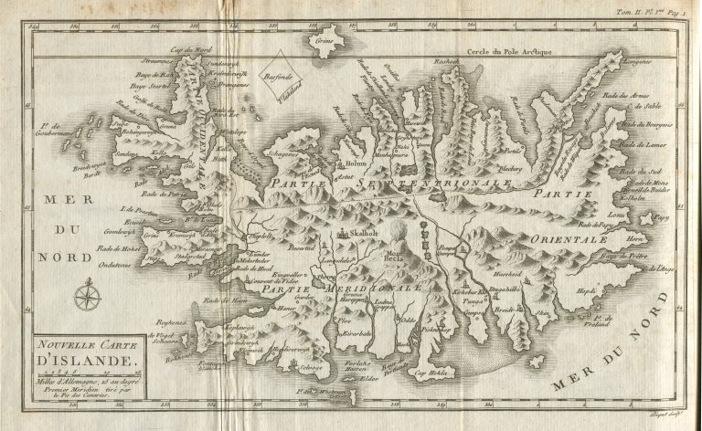
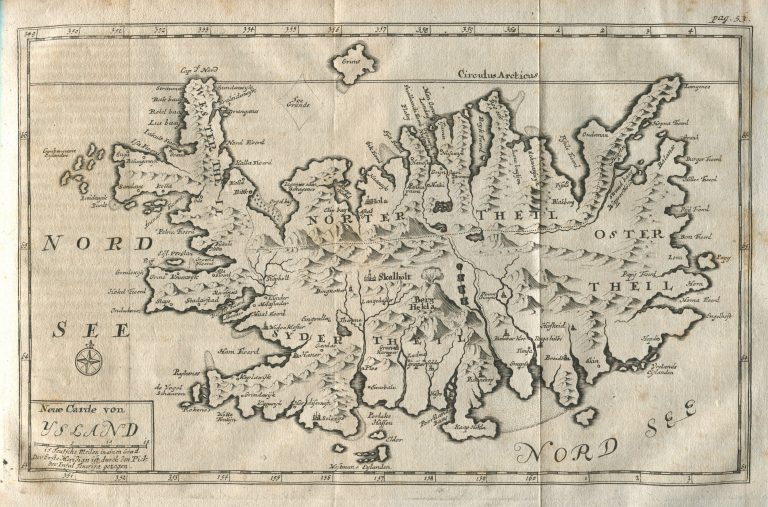
Zorgdrager’s account of Iceland appeared in a German version, Beschreibung des grönländischen Wallfischfangs und Fischerey […], 1723 and 1750. It has a map titled Neue Carde von Ysland. In French it appeared as Histoire des pêches, des découvertes et des établissemens des Hollandois dans les mers du Nord. Paris: Veuve Nyon, 1801, accompanied by the same map, but titled Nouvelle Carte d‘Islande.
Very similar map appeared in De Walvischvangst met veele Byzonderheden daartoe Betrekkelyk, Amsterdam 1784. Small changes from the plates from 1720 are noticeable by changed names on the East coast. Same map in Nieuwe beschryving der walvisvangst en haringvisscherij, Amsterdam 1791 (same book with new name!).
I include the German, French and slightly changed Dutch maps as different states of the original, rather than different maps.