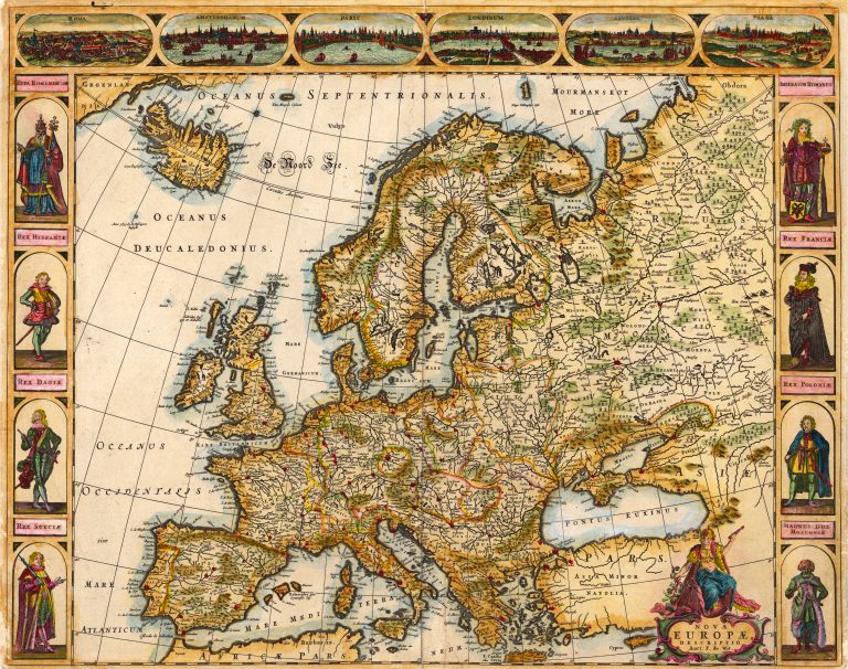
This is a so called carte-a-figures map of Europe, published by Frederick De Wit. Similar maps, showing contemporary dignitaries were made by several other cartographers, including Willem Blaeu, Jodocus Hondius Jr. and John Speed.
Iceland is in the shape introduced by Joris Carolos.