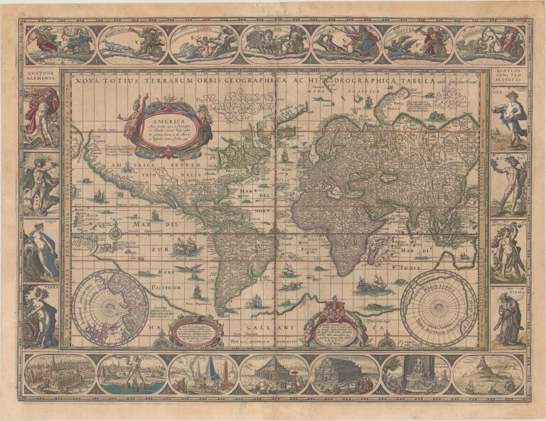
Willem Blaeu´s famous world map, first published in 1606. He uses Mercator projection from 1569. He would later vert do double hemispheric format, from 1658. Until that time this map would be in his atlases, published from 1630 onwards, before that time the map was issued separately.
This is co called carte-à-figures, showing figures representing the four elements on the left, the four seasons on the right and the planets, sun and moon above. Below are shown the 7 wonders of the ancient world.