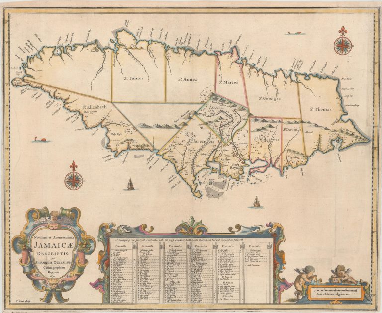
This important English map became the model for many later maps of the island. In 1670, Sir Thomas Modyford ordered a survey of the island, which was completed by John Man, the Surveyor General of Jamaica from 1661-71. The following year, John Ogilby, John Seller and Richard Blome each used the survey to publish maps of Jamaica.
Ogilby’s map, which closely resembles Seller’s version, shows showing the island divided into precincts. The most prominent settlements are depicted with the landowners named in the large key at bottom. Port Royal is correctly located, and there are numerous settlements shown in the southern portion of the island. Anchorages, rocks, shoals and depth soundings are identified along the coastline. The map is handsomely embellished with three strapwork cartouches, including a distance scale featuring two putti. Additional decorative elements include pairs of compass roses, sea monsters, and sailing ships. Engraved by Francis Lamb. [from Oldworldauctions.com]