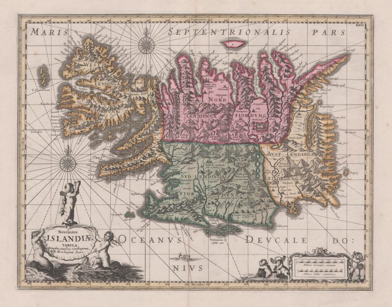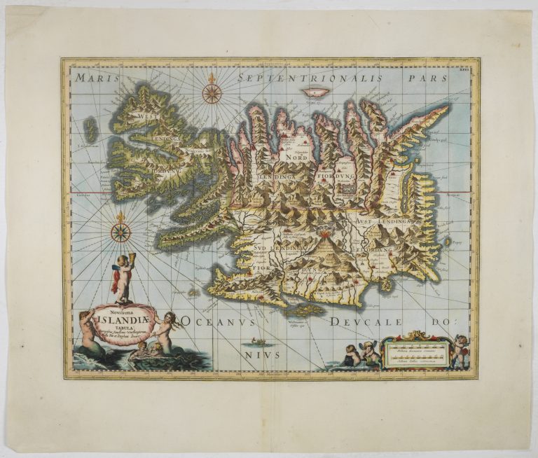
Moses Pitt published The English Atlas in the years 1680−1683. Among the maps included is a map of Iceland. Pitt acknowledges that he is basing his map on that of Janssonius. When it comes to the country itself, it looks like Pitt is merely re-using the same plates. The decorations are a bit different, with a new cartouche and frame, plus the addition of more extensive rhumb lines. There are more angels and less monsters. The ship of toe model map is gone.
It was actually Steven Swart who engraved the map and he is mentioned in the signature, along with Pitt. The title of the map is Novissima Islandiæ Tabula, or a new map of Iceland. Today it seems outrageous to use an old map and call it new, but back then this was a common practice. Pitt was overly ambitious with his project and he went bankrupt due to this publishing adventure. At this time that meant going to prison, where he stayed for seven years. After this failed venture, the plates somehow found their way back to the Netherlands, where a publisher called Carel Allard published the map of Iceland, from Pitt, unchanged.
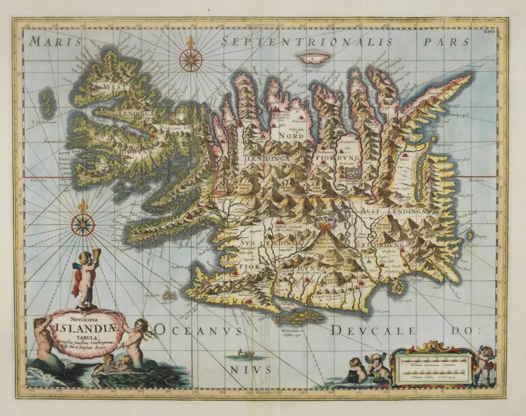
The plates then passed to the map publishers Petrus Schenk and Gerard Valk who changed the signature and republished the map in around 1690. Finally, the firm of Covens and Mortier published several map collections, one of which contained the Schenk and Valk map. The collection is not dated, but it has been suggested it is from around 1740.
I saw this map in a composite atlas said to have been published be Delisle around 1560. That could mean yet another publisher of the Carolus map, but this needs further investigation.