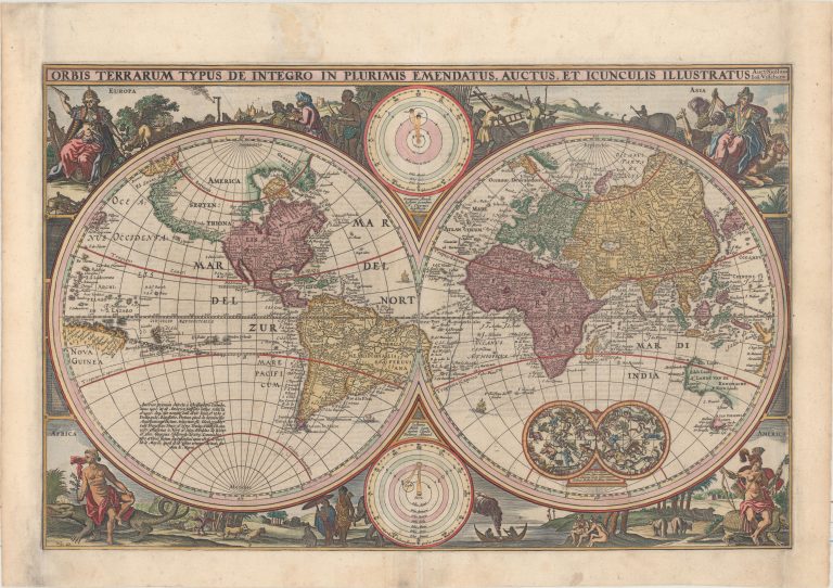
This map was one of several which Visscher prepared for Dutch Bible publications. It would be a model for Bible World maps for a century or so.
It is a double hemisphere map and as such leaves necessarily free space in the corners and the middle on the margins. In the corners, there are depicted the four continents. Australia was only half, or less, discovered. Notice that Novaya Zemlaya is still as Barents left it 60 years before. Gone are the times when mapmakers would simply guess where they had no information. Same can be seen in the case of Australia, the Dutch had sailed the West and South-West of the continent and this is shown, but no more. The other Australia or South-Land is gone and there is no Antarctica. In the middle of the margins are celestial charts, as was common on world maps at the time.
There are a lot of details on this map. A nice example is the tools of cartographers, in the Europa corner. That is where maps were coming from. Actually, the Chinese have been making maps for 3.000 years and there are ancient maps from other countries. The depiction is Euro-centric, from an era when that part of the world was in its ascendancy.