This monumental and important sea chart would be a role model for other hydro- and cartographers into the next century, for example, Frederick de Wit. There are only 11 recorded samples of it existing, of that this is one of three printed on paper.
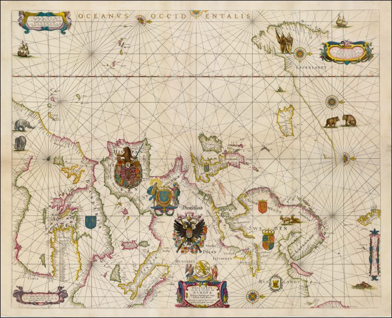
One interesting feature is that the East part of the Mediterranean has been accommodated in the interior of Africa.
The bears in the North look rather much like brown-bears, not Polar bears and one cannot fault the colorist for making them brown.
Johannes Vermeer used this chart in his painting The geographer.