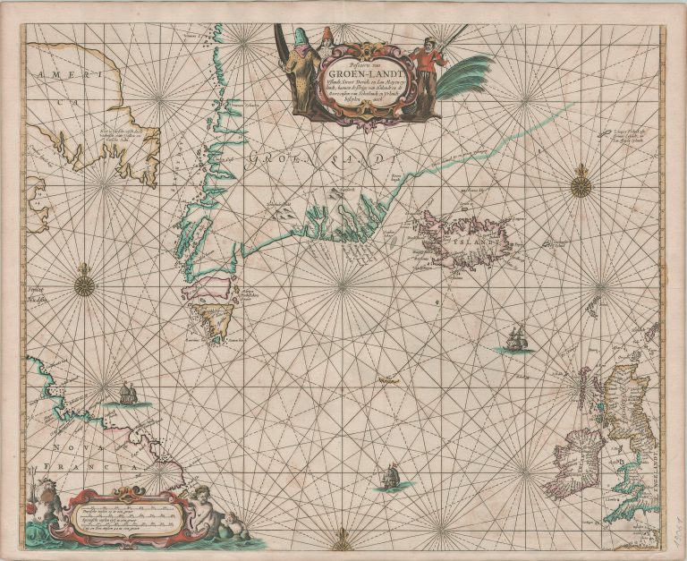
Goos had recently acquired tha plates of Theunisz Jacobsz, who had engraves smaller plates of this area in 1644. Good believed that it was right to have a bigger map of the area. Keep in mind that at this time there were many who believed that there were ways to sail to Asia by going North-East or North-West. Goos’ map seems to hint at passage North-West, with America having sea North of it. Another noticable thing is the straits cutting through South of Greenland, called after the man who discovered them, Martin Frobisher. They do not exist.
Iceland is shown in a shape common on Dutch sea chart at the time, while the cartographers making maps for landlubbers were mainly shaping Iceland as per Joris Carolos.