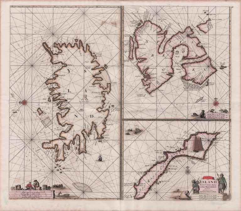
The first of three sea sharts of Iceland made by the Van Keulen family is Paskaarte van Ysland, Spitsberge, en Ian Mayen Eyland, the first sea chart where Iceland is the main subject. The three islands are shown on the same sheet. This is a map for navigation, as can be seen from the rhumb lines on the map. These were to help navigators set and follow a course to a specific point. Also, there is a compass rose to the left of the country. East is up on the map, a convention that seems odd
now but that used to be the norm, prior to the printing of maps. Another word for the East was the Orient and the word “orientation” comes from this, describing the directional position. Hekla is shown on the map with very long flames of fire, but the only other place labeled in the interior of the country is Skálholt, the bishopric. On the coast, there are many place names, particularly harbors. To the North (left) there are many numbers showing the depth of the ocean. This can have been based on accounts from fishermen, presumably, Dutchmen who were active there, but pinning down sources so late after the fact is very difficult. This tells us through where ships from Europe were most likely to be fishing at this time. Iceland has an interesting shape, which would be seen
again on several maps. The Westfords are perhaps furthest from reality, shown as mainly two peninsulas, one stretching West, and the other North.
Paskaarte van Ysland, Spitsberge en Ian Mayen Eyland
YEAR 1681
Technical data
Iceland
1681
Johannes Van Keulen
51 × 58,5 cm.