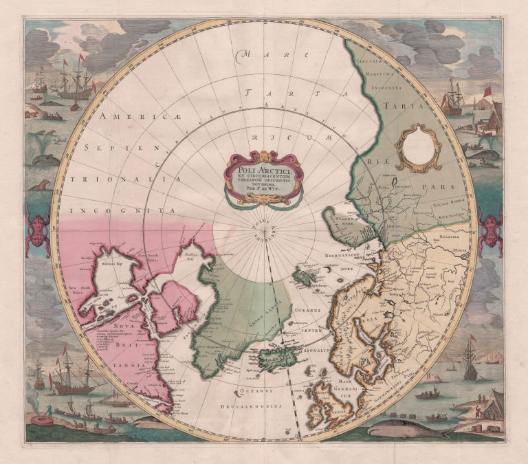
This beautiful map was made by Frederick De Wit in 1636 and later published bu others, including Luis Renard. The map is circular, reaching South to 50°N. Around it are beutifully carved scenes mostly dedicated to activities of Europeans in the far North, most noticably whaling. The West part of America is left blank, for lack of information; the time when cartographers just guessed when they didnt have information was mostly passed. Frisland has become the small island Bus.
Poli Arctici et circumiacentium …
YEAR 1636
Technical data
North Pole
1636
Frederick de Wit
Luis Renard
43 x 49 cm.