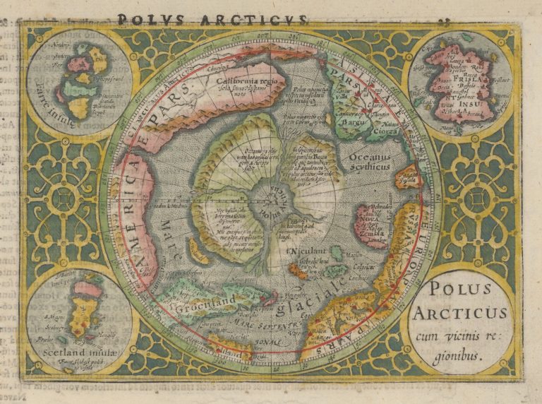
This is a miniature version of Mercators polar map, originally appearing as inset on his famous world map of 1569 and then published separately in 1595. The theory was that the North Pola area consisted of lands surrounding an inland sea, from which then four rivers flowed, separating the land into four parts. In the middle of the sea was a magnetic rock. And another one south of it, on the Asian side.
This map is derived from the second state of Mercators map. After Barents’ excursion, ending in 1597, it was clear that at least the land facing Scandinavia was not as theorized, Spitzbergen had been found where this land would have been. So the map was remade with this land cut back, allowing for Spitzbergen.