In 1616 Jodocus Hondius Junior published a book, P. Bertij Tabularum Geographicarum, with miniature maps. The text of the book is made by Petrus Bertius and the map is sometimes credited to him. Kaerius mostly used the Mercator/Hondius atlas as his model, this map is based on the second state of Mercator’s map of the North Pole.
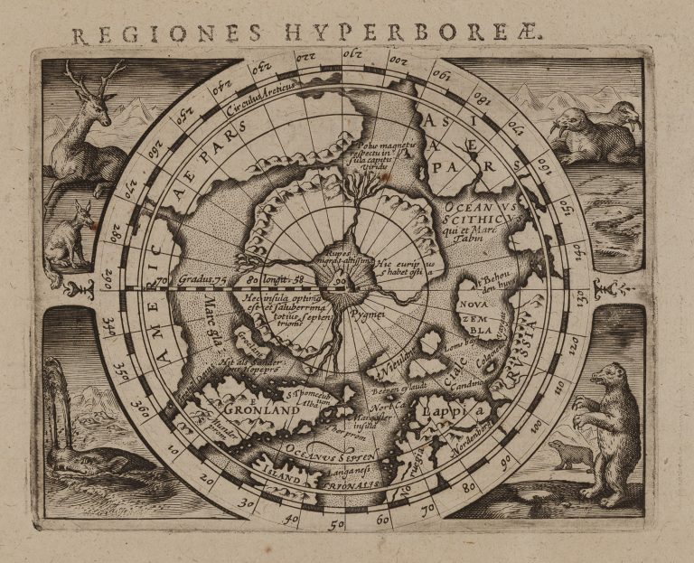
Regiones Hyperboreæ
YEAR 1616
Technical data
Arctic
1616
Petrus Kaerius
Jodocus Hondius Jr.
9,5 x 12 cm.