Like the Carolos map of Iceland, and a few other, this was issued by both the Blaeu’s and Janssonius. The versions are very similar, one being the copy of the other, probably in the same order as with the map of Iceland, i.e. Janssionius copying the plates Blaeu got from Jododus Hondiu’s widow.
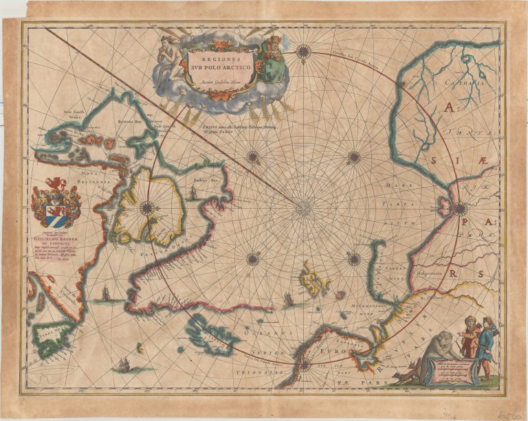
The Blaeu map has his Coat of Arms at the left margin and his name in the title shield.
The map shows the disciveries made by Barents on his ill faited excursion in 1597, where he died in the sea that was later given his name. Barents team had made it to Novaya Zemlya and rounded it from the North. The part of the island South of that remained uncharted. They had also reached Spitzbergen, likewise partly charted on the map. The North-West passage seems to be closed, but the North-East looks wide open for sailing to Asia.
South-West of Iceland is the island Bus, probably remnants of Frisland and definately not existing.