A stunning map showing the North Pole region from the Atlantic side and neighbouring regions, down to Britain. The Canadian acctic is not very well defined nor is Greenland well shaped, but the map is rather acdurate for its time. It is also very beutiful witl all its scene of animals, hunting, ships and even a market in Lappland.
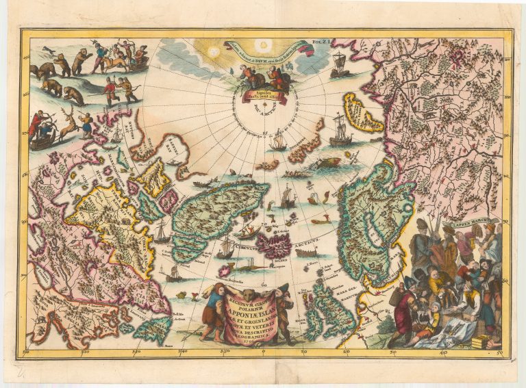
Regionum Circum Polarium Lapponiae Islandiae et Groenlandiae Novae et Veteris Nova Descriptio Geographica
YEAR 1701
Technical data
North Atlantic
1701
Heinrich Scherer
23 x 34,7 cm.