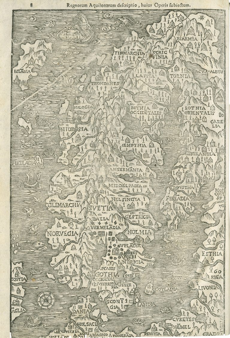
The map was published by Johannes Magnus (Olaus ’ brother) in Historia de omnibus gothorum suenumque regibus in Rome a year before it appeared in Olaus Magnus book Historia de gentibus septentrionalibus in Rome 1555. The map is made to fit on one page and therefore is much less detailed than previous Magnus‘ map Carta marina. In addition, following the Carta marina, this map is a bit of a letdown. It is not very well done and in the case of Iceland, it is a step backward. The wrong orientation (too much SW/NE, as opposed to W/E) is more pronounced here, and the country is much too close to Norway. The shape of the island was also better on the Carta marina. At least Thule is gone.
Scandianæ Insula Index
YEAR 1554
Technical data
Nordics
1554
Olaus Magnus
26 cm x 16,7 cm.