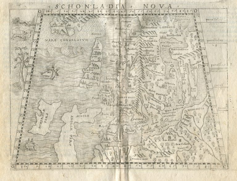
Gastaldi is likely using Münster’d Schonlandia as his model. Iceland is terribly out of shape. Iceland now appears closer to Scandinavia then on the model and Greenland looks like it has shrunk northwards. Iceland’s position N/S is between 63 and 69° North, as in the case of the Ziegler map or 1532. The island is called both Islandia and Thyle, the latter in bigger letters, and it has three clear place names (plus 2 that don’t make sense), Hekelfol (Hekla/Heklufjall), Holen and Skalholten, which make the identity of the country clear. The shrunken Greenland is not so named anymore but is now Islandia and it too has the place names Holensis and Skalholdin!
The map was published in Ptolemy’s Geography in Venice.