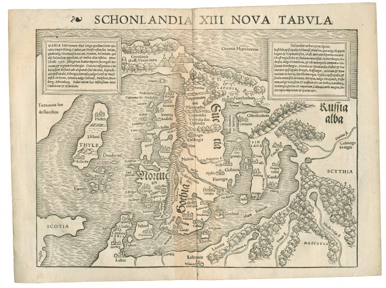
This map is based on the map of Ziegler from 1532. Two large buildings represent the Bishoprics, the only place names on the map, and he shows two chains of mountains.
Münster was one of the foremost cartographers, however, he was not really progressing cartography of Iceland by using Ziegler as his model. The country is still mostly in a N/S alignment. To make matters worse, he put the name Thyle on the island, in much bigger letters than Island.
The map was first published in Ptolemy’s Geography in Basel.
Thomas Kitchin made a copy of this map in 1770, I don’t know why, as the Schinlandia was outdated very soon and certainly by 1770!