In 1570 in Antwerp, Abraham Ortelius published a collection of maps, the Theatrum Orbis Terrarum, the first atlas with standardised maps. Among the maps published there was a beautiful map of the Nordics titled Septentrionalium Regionum Descrip. It is closely based on the corresponding region on Mercator’s world map from 1569. Iceland there also resembles that of Magnus’s 1567 map. South and Southwest of Iceland are a few islands, the biggest one being Frisland. Iceland is now more or less in the right northerly latitude, South of the Arctic Circle (actually, Iceland lies between the 63.4° and 66.5 °N). On the reverse side of the map is a text describing the region, as was common at the time. In the English version, published in 1606, the following is said about Iceland, “In this chart there is described also ISLAND, an Iland as famous as any other for strange miracles and secret works of nature”. There is a monkey on the cartouche.
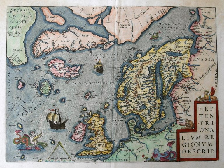
Septemtrionalium Regionum Descrip.
YEAR 1570
Technical data
Nordics
1570
Abraham Ortelius
36,1 x 49,1 cm.