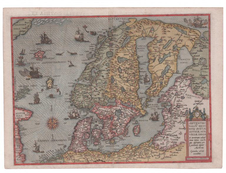
This map is based on the maps of Olaus Magnus. It is is not available to collectors due to its scarcity, as is often the case with larger maps. It is actually a remake of a map made by Liévin Algoet published a map in 1562, but so scarce it is not available to publishers. De Jode‘s map is very beautiful, engraved by brothers Joannes and Lucas van Doetecum, the most respected Dutch engravers of the time. Iceland only just makes it onto the map, and only a portion of the country is shown. The country is rotated too much in a SW/NE direction and details are lacking. The map is quite decorative, with ships and monsters dotting the sea. The drift ice is East of the country. One strange thing we can find is the place name Bergen on the East coast of Iceland. This is actually a town in Norway. The country lies mostly on 70−72° North, so it is slowly inching southwards from Magnus’ lofty latitudes.
This map was published In Speculum Orbis Terrarum.