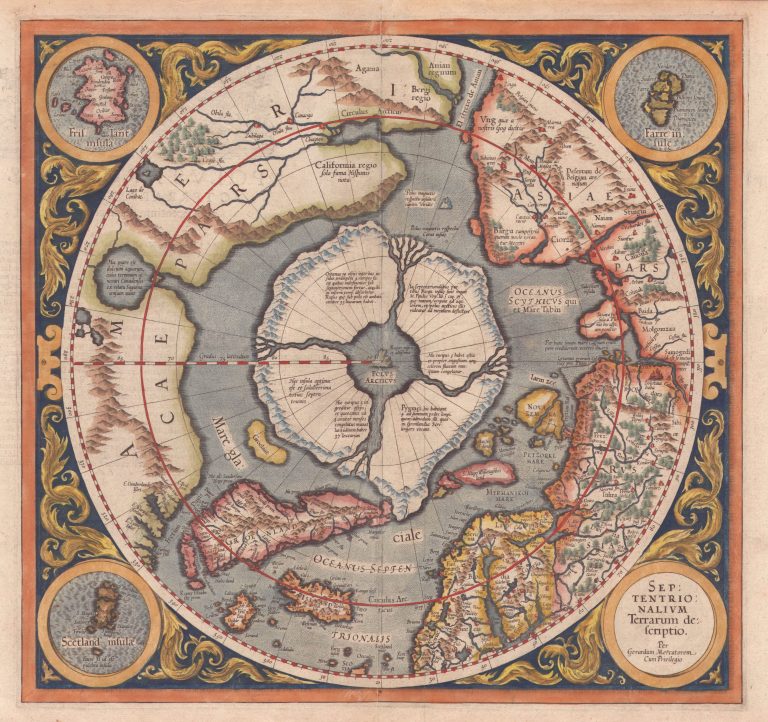
In 1569 Mercator published his famous world map, pioneering the Mercator’s projection, where there was an inset map of the North Pole, the first map dedicated to the region. This map, improved, was published in his atlas of 1595 as a separate map, titled Septentrionalium Terrarum descriptio. This is a spectacular map, even if it is not accurate in geographical terms. Mercator believed that the North Pole consisted of four islands, split by rivers. In the middle, there was a magnetic stone, the reason why compasses pointed North. Iceland is shown on this map in Gudbrandur‘s shape. In the upper right corner there is an inset map of Frisland with almost thirty place names, none of which seem to belong to Iceland.
The map appeared in Atlantis pars altera and Atlas sive Cosmographicae.